
Leominster Previous Residents by Era
Previous residents of a Leominster address leave different kinds of evidence in different eras. The Worcester Registry can establish a recorded property chain. The library's directory and street-list holdings can show a published address for a date. Maps, plans, newspapers, and municipal reports add context when a house number changes or a person is absent from one source. Begin with the source nearest to the period in question, and record both the source date and the relationship it proves.
| Source | Years it covers | Where held | What it shows |
|---|---|---|---|
| Worcester deed index and images | 1731 to present | Worcester Registry of Deeds and Land Records portal | Recorded parties, instrument, date, book/page, plans, and legal description |
| Leominster city directories | 1900 to 1990 | Leominster Library; 1915 sample online | Published resident or business address for a directory year |
| Street lists and city reports | Street lists 1958 to present; city reports 1866/67 to present | Leominster Library reports collection | Dated local listing and municipal context |
| Newspapers and microfilm | Enterprise weekly 1873 to 1903; daily 1895 to 1973, with later listed runs | Library and Advantage Archives | Notices, obituaries, moves, sales, and local events |
| Atlases, plans, and Sanborn maps | Late nineteenth and early twentieth centuries; date varies by item | Library Reference Desk, Registry, and map archive | Street course, lot, building, and land-use context |
The era table is a starting order, not a claim that each source records every Leominster household. A property owner on a deed and a directory listing at the same address may be different people with different dates.
Start at a Leominster Parcel
Use the Leominster GIS Database to start an address history with the current mapped parcel. The optional Address, Parcel ID search accepts a street address or parcel identifier. Its dynamic result card can show the parcel ID, owner, address, unit or complex details, and a Parcel Details link. Save the exact spelling of the situs address and parcel ID before looking at older records.
Then check the Leominster Assessors Office route for the fiscal assessment record. It values about 15,000 parcels each year and can supply an assessment owner, mailing field, values, sale clues, and building facts. The owner mailing field is for tax correspondence and may be outside the city. The parcel's situs field identifies the physical Leominster location. Neither field alone proves who lived at the address.
Keep a simple dated flow: parcel and situs address, then assessment owner, then recorded deed party, then a directory or street-list name. That order prevents past-resident research from turning a mailing contact into a historical resident.
Note: Record the fiscal year beside each Leominster assessment result because values, owners, and building fields are time-specific evidence.
Trace Leominster Deeds Backward
The Massachusetts Land Records Worcester portal is the legal-property layer for a Leominster previous-residents trail. Modern searches can use Recorded Land name, document, book, property, or recorded-date modes, with Leominster available as a town filter. Open the most recent relevant instrument and capture the parties, party roles, document type, recorded date, book/page or document number, legal description, and earlier-instrument reference.
- Start with the Leominster GIS and assessor result. Record the parcel's situs and the current assessment owner as a starting lead.
- Find the latest property or party result in the Worcester Recorded Land search. Open the deed image rather than relying only on the index row.
- Record the grantor, grantee, date, book/page, and any reference to an earlier deed, plan, or lot description.
- Search the seller as grantee to locate the prior acquisition, then search the buyer as grantor when following a later transfer.
- Repeat with the legal description and plan clues when the street address does not appear in an older instrument. Check Registered Land if Recorded Land has no result.
Trusts, estates, corporations, spouses, personal representatives, and attorneys can appear as parties in a Leominster chain. Read the party role and instrument before deciding what a name represents. The deed chain identifies recorded ownership interests, not a continuous list of occupants.
- Grantor
- The person or entity transferring an interest in a recorded instrument.
- Grantee
- The person or entity receiving that interest. Searching both roles can expose the next link in a chain.
- Chain of title
- The sequence of recorded transfers connected by instruments, party roles, and references to earlier records.
- Legal description
- The lot, boundary, plan, or other formal property description. It can be more durable than an old street number.
Leominster Pre-1960 Grantor Pages
For earlier Leominster deeds, the online system changes from a modern property search to scanned grantor and grantee index books. Select the relevant index-year range, search a last name, inspect the returned index page, open the name, and use View Images. The book and page found in that index are the keys for the portal's Unindexed Property Search. This is the documented route for pre-1960 property work, not a reason to assume the record is unavailable.
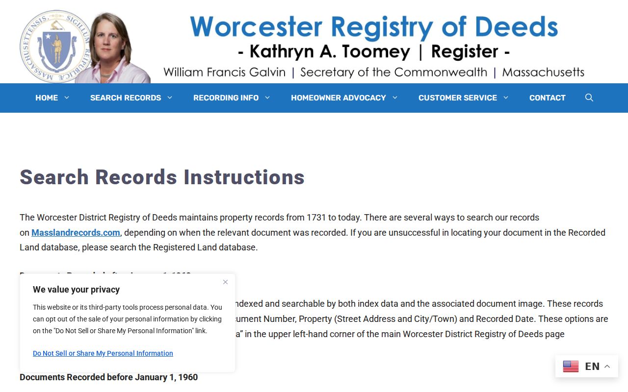
The Worcester Registry search instructions illustrate the pre-1960 grantor and grantee workflow for a Leominster address history.
Once an index page yields book and page, compare the instrument's legal description and prior reference with the current parcel before adding a party to the past-residents trail.
This index method is an important practical check. Searching a seller as grantee and a buyer as grantor gives the direction of a transfer, while the deed image supplies the detail that the street address may omit.
Note: The older Worcester index page is a discovery step; use its book and page to retrieve and read the actual instrument image.
Leominster Maps and Old Addresses
Leominster address history sometimes depends on a map rather than a name. The city retired its paper assessor maps in 2005 after converting to digital GIS, and PDF map sheets 001 through 588 remain useful for historical orientation despite gaps in the sequence. Recorded plans, old assessor sheets, historical atlases, and current GIS parcel views can connect a lot or road course across time.
The Leominster Library also has late nineteenth- and early twentieth-century atlases and offsite Sanborn fire-insurance maps on Leominster Reel 22, requested through the second-floor Reference Desk. A Sanborn map can date a building footprint or land use. It does not name a resident. Use the map to test whether an older description belongs to the same parcel, then return to the directory or deed for a name-and-date source.
There is no verified citywide street-renumbering date. When an old Leominster address appears to vanish, compare the same street in the 1915 or an adjacent directory, its Street Guide, the deed plan, an old map, and the current parcel. Mark any bridge as an inference until the City Clerk, assessor, or legal description confirms it.
Leominster Past Household Clues
The Leominster Library's Local History and Genealogy collection holds city directories from 1900 to 1990, most telephone directories from 1981 to the present, annual reports, street lists, newspapers, and local microforms. Those sources can add the household layer that a deed cannot supply. The full collection runs and how to read each volume are available through the Leominster City Directories collection page.
The digitized 1915 Price & Lee directory is a clear model for earlier clues. Its entries can combine initials, occupation, an address, a business address, and shorthand. Its Street Guide lists streets alphabetically with compass courses and cross streets. “N L” means North Leominster, while “h,” “rms,” “bds,” “wid,” “rem,” and “do” must be read with the volume's own abbreviation key.
Pair a directory year with other evidence from the same period. A useful sequence is directory entry, Street Guide, newspaper or obituary, and then an independently available census record where it helps identify the household. An absence in a single volume may reflect a move, a change in listing, or directory editing. The 1915 compilation itself recorded additions, removals, erasures, and address changes.
Note: A historical directory address is evidence for that directory year and should never be presented as a current location.
Leominster Obituary and Probate Ends
Obituaries and probate records can help close a historical Leominster address trail, especially when a person disappears from a directory. The library's Local History Room keeps family and person folders plus clipping cabinets, though the library warns that the clippings are not exhaustive and are strongest in the later twentieth century. Library staff offer limited obituary and brief newspaper research in person, by telephone, mail, or email through a request form.
For an obituary request, give the name, death date at least to month and year, and the last residence city or town. The library says it responds within 48 hours with an estimate or result status. The Advantage Archives advanced search also supports full text, people/places/events, city and title filters, and From/To dates. Search a surname, street, and event separately because OCR can miss a name or an old abbreviation.
A probate file may be relevant to an estate or heir question, but it is not a general address list. Worcester Probate and Family Court and its virtual registry are the appropriate official routes. Access can vary by case type, document, impoundment, and remote-access rule.
Leominster Records Need Dates
Leominster past-resident research is strongest when every result keeps its original relationship. A parcel record can show a fiscal owner. A deed can show a grantor or grantee. A directory can show a published residence or business address. A street list or voter record can show a listing or registration status in a defined period. These records may agree, but they do not become identical simply because they share a street number.
Use a compact evidence flow: current parcel → assessment owner → recorded deed → older deed or plan → directory or street list → newspaper or obituary. The arrow describes an evidence sequence, not a claim that every step names the same household. It also helps identify the point where a Leominster address needs more research instead of a guess.
Note: A dated Leominster source can corroborate another record, but it should not replace the relationship shown by that separate original source.
Leominster Previous Residents Limits
Previous residents records do not authorize a reconstruction of a protected person's location. Massachusetts offers an Address Confidentiality Program for qualifying participants, and qualifying court matters can use a substitute address under SJC Rule 1:20. Do not use a substitute address, a map, or another public record to infer a confidential location.
Minimize the search. Use the narrowest address and time period, preserve the source date, and leave out protected contact fields. A record that can be viewed at a custodian office is not automatically suitable for a consolidated or republished address history.
Lawful use. Leominster house-history and family-history research must remain lawful and respectful. Do not use records to stalk, harass, or harm any person.